The Path the Jaredites took
I got curious about the journey the Jaredites took, since they are so different from the rest of our Hebrew and Greek scriptures. And because their journey appears to have taken place near the end of the Ice Age.
The account in Ether is highly abbreviated. It appears they traveled eastward, in part because Hugh Nibley pointed out that the Book of Ether resembles early Chinese historiography in form.
Siberia / Northern Asia doesn’t match well. There were no long stretches with “many waters”. Seasonal freezing would severely limit repeated barge use. And continental interiors do not produce sustained, dominating wind systems. Ether does not describe prolonged cold, frozen travel, or famine.
The Tibetan Plateau/ Central Asia was my first guess, but it doesn’t work well either. Extreme altitude and hypoxia are never mentioned, nor is river travel. Surface water on the plateau itself is sparse. Travel logic favors rapid crossing, not repeated habitation. Winds are strong but episodic, not system-scale and entraining. This might have been easier in terms of overland travel, but this suggests the Lord deliberately placed them in environments where they gained repeated experience building barges, because they would need that practice when they built their final ones.
What does work, is a journey across Iran, India, south of the Himalayas and ending in Southern China or Southeast Asia, like Vietnam.
This time period (ca. 4000–5000 BC) was the end of the Ice Age. It was “post-glacial”, but that does not mean calm. The continental ice sheets had retreated, but alpine glaciers and glacial lakes remained active. This produces significant environmental instability. So, we can expect glacial-lake outburst floods, paraglacial landslides, rapid slope failures, and in general, highly energetic seasonal climate systems. And of course, glaciers in retreat. Descriptions such as “a mountain moving” fit these phenomena well without requiring tectonic upheaval, which we have not found. In other words, the account of Mount Zerin (Ether 12) being moved by faith may plausibly reflect the movement or collapse of a glacier or ice-dammed mass.
This path includes glacial lakes for them to cross, and collapsing glaciers.
Ether’s language about wind is experiential, not technical. Still, the severity and duration deserve explanation.
Several mid-Holocene factors converge:
-
Stronger land–sea temperature contrasts after deglaciation
-
Warmer oceans, intensifying ocean–atmosphere coupling
-
Monsoon and trade-wind systems operating near Holocene maxima
-
Fewer prolonged calm intervals during seasonal transitions
This does not require continuous hurricane force.
It requires continuous dominance—a wind that never stops mattering.
For people in unsteered barges, that distinction is irrelevant.
Although Genesis, as we have it, does not specify how the Tower of Babel was destroyed, later traditions do. Across Jewish, Islamic, and Near Eastern literature, wind is repeatedly portrayed as an agent of divine judgment. Entire peoples are destroyed by relentless wind lasting days or longer. Mesopotamian literature treats wind as an impersonal force that undoes human ambition. Some traditions explicitly associate Babel’s fall with violent atmospheric forces.
So, where does that leave us for viable places on the eastern shore of Asia, for the Jaredites to build their barges and for the Mount Shelem, where the 24 stones were made?
An important constraint is that not all quartz is transparent. Most quartz in granitic regions is milky or opaque; truly clear, light-transmitting stones require low-impurity quartz formed in pegmatitic or hydrothermal settings. This means that Mount Shelem must have been located not merely in a quartz-bearing region, but near a source capable of producing rock crystal of sufficient clarity to transmit light.
A. Vietnam (Annamite Coast) (Weaker Fit)
-
Quartz-bearing mountains exist
-
Coastal access is present
However:
-
Wind exposure is more sheltered
-
The region opens more toward the South China Sea than the open Pacific
-
Less suited to a year-long, wind-dominated drift
Vietnam works marginally, but weakly so.
B. Southern China — Guangdong (Strongest Fit)
At the level of consistency, Guangdong stands out:
-
Natural terminus of a southern, river-rich migration arc
-
Coastal, facing directly into Pacific wind systems
-
Immediate exposure to monsoon–trade-wind interaction
-
Rich in granitic, quartz-bearing mountains
-
Located at a cultural interface where Chinese historiographic forms later develop
Guangdong works the most naturally, and fulfills the evidence we have, the best.
But which mountain is the Mount Shelem, where the 24 stones were forged?
If Mount Shelem was remembered for stone, light, and significance, certain mountains deserve attention.
A. Nanling Mountains
-
Massive granitic system spanning Guangdong
-
Feeds major river systems into the Pearl River basin
-
Easily remembered as a single “mountain” in compressed tradition
- One of the largest pegmatite provinces in South China
- Historically mined for crystal, tin, and rare minerals
- But quality of quartz is heterogeneous. Many locations produce milky or smoky quartz, not optical-grade crystal
B. Dinghu Mountain and nearby Nanling peaks
-
Smaller but quartz-bearing
- Not known historically or geologically for large, high-clarity crystals
-
Very close to navigable waters
-
Plausible secondary candidates
C. Luofu Mountain
-
Granitic, quartz-rich geology, including pegmatitic quartz capable of producing clear crystal
-
Later revered as a Taoist sacred mountain
- Close enough to the Pearl River estuary for transport and shipbuilding
-
Repeatedly associated historically with unusual stones and minerals. Alchemical materials (which strongly favored clear quartz)
-
Later traditions associate the mountain with illumination, though this language probably reflects later theological development rather than early belief.
D. Vietnam (Annamite Range), for comparison
-
Quartz present, yes
-
But pegmatites there are less famous for large, clear crystals
-
Much more common: milky quartz, vein quartz, quartzite
-
Historically weaker crystal tradition
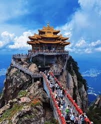
Luofu is especially notable because it combines holiness, stone, light, and proximity to departure in a way that is rare and textually suggestive.
The image above is from Luofo Mountain.
Filed under: Deseret Review,We transcend your bourgeois categories | No Tag
G.
January 31, 2026
Cool image!
Genesis is impossible to reconcile with our current understanding of prehistory and geography
The record of the jaredites suggest that we should not be too quick to assume that it’s all legend as opposed to our understanding of prehistory and geography needing a major overhaul
I found your argument convincing in isolation but to be very convincing it would need to fit into an overall overhaul of our understanding
Zen
January 31, 2026
G – there is more evidence that I didn’t review, that strongly suggests the Flood was an Ice Age glacial lake outburst, or something much like it. For instance, there is an ancient record that mentions Noah getting frostbite.
But you are right, I didn’t prove that. But it would be consistent with the time period.
In any case, I got it far enough to post, so I could concentrate on a different post. I have recently come to really understand Jonah, and the nuclear grade snark it was written with, to condemn the apostate Deuteronomists.
G.
January 31, 2026
It was all great. I look forward to much more in the same vein.
Including Jonah.